
Tropical Storm Isaias: A 48-Hour Flood Prep Checklist for the Gulf Coast
Isaias is forecast to hit the central Gulf Coast as a hurricane this weekend, and outdoor work will have to stop by midday Friday. Here's what to do today, tomorrow, and Friday morning.
Tropical Storm Isaias is strengthening in the southern Gulf and heading for the U.S. coast. On Wednesday morning, the National Hurricane Center issued a hurricane watch from Bay St. Louis, Mississippi, to Indian Pass, Florida, and a storm surge watch from the mouth of the Mississippi River to Yankeetown, Florida. AccuWeather projects a Category 2 landfall late Friday night or early Saturday. If Isaias becomes a hurricane, it will be the first of the 2026 Atlantic season, and AccuWeather says the latest first hurricane in more than 100 years.
Agencies, contractors, and property owners have about 48 hours. Use today to decide what you need and order it, Thursday to stage material and build, and Friday morning to finish.
Prep Stops Friday Midday, Not at Landfall
NHC says tropical storm conditions could begin in the watch areas midday Friday, with hurricane conditions possible late Friday. A hurricane watch goes out about 48 hours before tropical-storm-force winds arrive, because those winds make outdoor work difficult or dangerous. Once gusts reach 40 mph, crews can’t safely place barriers, move equipment, or clear drains.
As of NHC’s 10 a.m. CDT advisory on Wednesday, October 7, the forecast calls for 5 to 7 feet of storm surge from Ocean Springs, Mississippi, to Indian Pass, Florida, including Mobile Bay. Surge could reach 3 to 5 feet on either side of that stretch and 1 to 3 feet in Lake Pontchartrain. AccuWeather’s numbers are higher, at 6 to 10 feet for Alabama and the western Florida Panhandle.
Rain totals of 3 to 6 inches are likely from far southeastern Louisiana to the Florida Panhandle, with local totals up to 10 inches, and 1 to 3 inches could fall as far north as the Tennessee Valley and the Carolinas. Last week’s heavy rain left the ground saturated in parts of the region, according to AccuWeather, so less of this rain will soak in.
Forecasts change with each advisory. Check NHC’s latest advisory and your local National Weather Service office before you act on any number here.
Wednesday: Decide and Order
Start by working out where the water will come from. Isaias will bring two kinds of flooding, and they reach a property from different directions.
On the coast, surge pushes seawater inland from the shoreline. NHC says the deepest water will come near and east of the landfall point, with large waves on top, and the depth will depend on whether the peak arrives at high tide. Coastal barriers go on the water side of what you need to protect, and they have to hold up against wave impact and scour.
Inland, rain pools in low spots, backs up storm drains, and flows off saturated ground toward roads and buildings. Barriers there go across drainage paths and along the low side of structures.
- Check your site against NHC’s peak storm surge graphic and the Weather Prediction Center’s flash flood risk graphic.
- List what can’t flood: lift stations, low road crossings, building entrances, gaps in dunes, evacuation routes.
- Count the barriers, fill material, and equipment you have on hand, and note where each one is.
- If you’re short, call suppliers now and get a confirmed delivery time. Barriers ordered after today may not reach the coast before Friday, so plan a fallback for anything that can’t arrive in time. Our roundup of sandbag alternatives compares the options.
- Assign crews, machinery, and deployment sites. Put surge zones first, since the coast will close to outdoor work earliest.
- Photograph shorelines, seawalls, dunes, and building exteriors so you can document damage for insurance and repairs.
Thursday: Stage and Build
Get material into place and start putting barriers up at the coast.
- Stage fill near each deployment site so trucks aren’t crossing town in rising water.
- Begin surge-zone deployments. For placement, see how to prevent storm surge damage and our guide to coastal storm surge barriers.
- Clear culverts, storm drains, and outfalls before the rain bands arrive. Our stormwater management page covers where barriers help.
- Protect evacuation routes and the low crossings that flood first. See how to protect roads from flooding.
- On job sites near water, move equipment off low ground and close off open excavations.
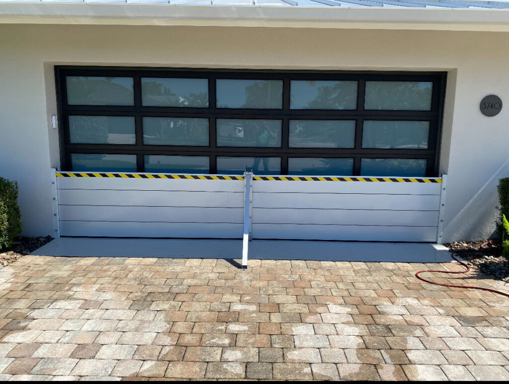
- Put barriers across doors, loading docks, and garage doors on the side the water will come from.
- Lift records, inventory, and equipment off the floor in ground-level rooms.
- Homeowners can follow our guide to hurricane home protection before, during, and after a storm.
Friday Morning: Finish and Clear Out
The barriers should be up by now. What’s left is inspection and cleanup.
- Walk every barrier line, check joints and ends for gaps, and tie each end into high ground.
- Clear debris from drains one more time.
- Know the difference between a flash flood watch and a warning. When this much rain falls on wet ground, one can follow the other quickly.
- Stop outdoor work when tropical-storm-force winds arrive, and follow local evacuation orders.
After Landfall
Flood risk continues after the center moves inland. Isaias is moving fast, and AccuWeather expects it to cross the interior Southeast and possibly reach the Ohio Valley before it exits off the mid-Atlantic coast early next week. Rain will fall across the Southeast through the weekend, and rivers can crest days after the rain stops. Leave barriers in place until local officials confirm water levels have dropped. Once it’s safe, check seawalls, dunes, and riverbanks for undermining. For the flood outlook past this storm, see our guide to the super El Niño winter.
How TrapBag Helps
TrapBag® barriers come in 50-foot sections that connect end to end and fill with local sand or soil, so a smaller crew can put up a long flood line than a sandbag wall of the same length would need. In 2011, the Pontchartrain Levee District and the U.S. Army Corps of Engineers placed two miles of 4-foot TrapBag barriers along the Mississippi River in Baton Rouge, and the line held through the flood crest. TrapBag is headquartered in Fort Myers, Florida, and supports hurricane protection, coastal protection, and flood protection across the Gulf.
If Isaias puts your site in its path, call TrapBag at (239) 674-6611, available 24/7, or contact us to talk through what you can still protect before Friday.
Meet the author

Nick Fasano
Nick Fasano is Business Development Director at TrapBag®, where he oversees operations, growth strategy, and customer success. Since joining in 2018, he has helped lead projects across the U.S. and internationally, including deployments in Florida that protected infrastructure during Hurricanes Ian and Nicole.
Get the Dirt Before the Flood Hits
Stay ahead of flooding, erosion, and disaster response challenges. The Dirt, TrapBag’s monthly newsletter, delivers field-tested tips, real-world case studies, and the latest in barrier technology straight to your inbox.